All photos and text Copyright © 2001-2003 Gordon Richardson gordonr@iafrica.com
Click on thumbnails to view full size
All images are compressed Jpegs - mostly 800x600 (<45K)
Note: Large areas of fynbos south of Kommetjie were burned on 16 to 19 January 2000
Chapman's Peak and Noordhoek from Karbonkelberg - Jul '03

Chapman's Peak and Kommetjie from Karbonkelberg - Mar to May '01


Burned areas of Kommetjie from Western Silvermine - early Jul '00

View from Karbonkelberg past Chapman's Peak to Noordhoek and Kommetjie
photo courtesy of Kevin Richardson

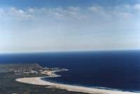
View over Noordhoek beach to Kommetjie - June '99
Karbonkelberg, Hout Bay and Chapman's Peak from Kommetjie - Dec '98


Click here to see the view from Table Mountain in Oct '01
Burned Chapman's Peak from Kommetjie - mid Jan '00

Field of white daisies near Kommetjie - Sep '93
