Gordo's photos of the Atlantic Coastline
All photos and text Copyright © 1998-2003 Gordon Richardson
gordonr@iafrica.com
Click on thumbnails to view full size
All images are compressed Jpegs - mostly 800x600 (<45K)
Model glider from Signal Hill with Robben Island -
Winter '94
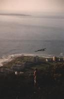
It looks like this model glider is trying to fly over Robben Island,
which is in fact more than 6km away.
Click here to see more views from Signal Hill.
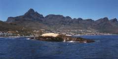
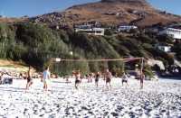
Camps Bay with beach -
Autumn '96

The photo on the left is Camps Bay from
Kloof Nek
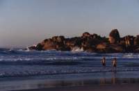
Table Mountain and Twelve Apostles from near Clifton Beach
photo courtesy of Andries Laubscher
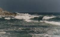
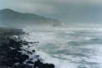
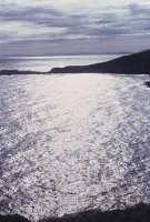
Waves off Bantry Bay and Sea Point - July '98
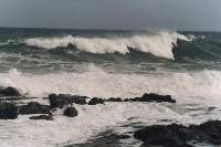
Atlantic waves breaking on Oudekraal pebble beach
photo courtesy of Kevin Richardson
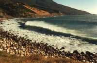
This is one of the nicest beaches near Cape Town, but also one of the
hardest to get to, with limited parking and no public transport.
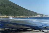
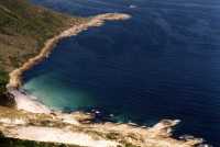
Oil-spill on beach at Sandy Bay -
early Jul '00
One of the most secluded beaches on the coast, it was hit by an oil-spill
on 3 July 2000
Sandy Bay from Little Lion's Head -
Dec '01
Wreck and Atlantic Coast from Oude Skip -
Oct/Nov '03


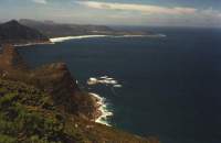
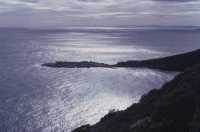
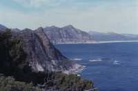
Sandy Bay and Atlantic coast from Karbonkelberg -
Oct/Nov '03


View from Karbonkelberg of Table Mountain and Lions Head and Robben Island
photo courtesy of Kevin Richardson
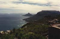
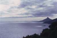
View from Karbonkelberg past Chapman's Peak to Noordhoek and Kommetjie
photo courtesy of Kevin Richardson
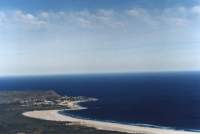
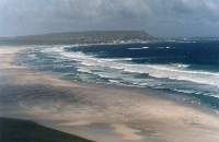
Views over Noordhoek beach to Kommetjie south of
Hout Bay - June '99 and July '98
Scarborough Bay with ship aground -
Aug '01
The ship ran aground during the night, but no lives were lost
June '82
Atlantic Ocean and Lions Head from Karbonkelberg
Headland with isthmus from Karbonkelberg
View from Karbonkelberg to Chapman's Peak and Noordhoek
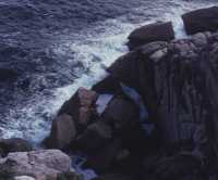
Granite rocks and sea
From here you can go:
north to Milnerton beach with views of Table Mountain
along the entire Western Cape Coastline
on a general tour of the Peninsula
north east to Kloof Nek and Table Mountain
south to Hout Bay
[ Satellite Map |
Home page |
Links page ]
06 Jan 2004 updated
23 Mar 1998 created


